English
 Español
 Deutsch
 日本語
日本語 Polska
 Français
 中國
中國 한국의
한국의 Українська
 Italiano
 Nederlands
 Türkçe
 Português
 Bahasa Indonesia
 Русский
 हिंदी
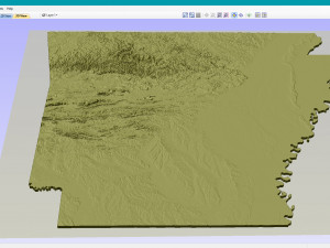
हिंदीArkansas Topographic Map STL Models 3D 打印模型


- 可用的格式: Stereolithography: stl 450.86 MB
- 集合:No
- 以毫米为单位的宽度:221
- 以毫米为单位的高度:1.1
- 以毫米为单位的深度:188
- 打印准备:No
- 3D扫描:No
- 成人内容:No
- PBR:No
- 人工智能培训:No
- 日期:1700
- 日期: 2022-06-15
- 项目 ID:402079
- 评分:
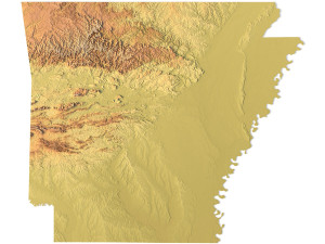
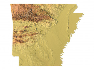
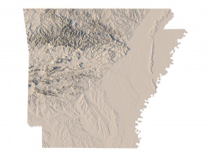
Create Detailed Arkansas Terrain Models with This High-Resolution 3D STL
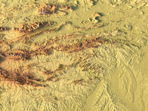
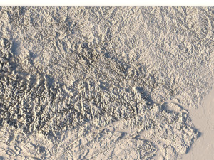
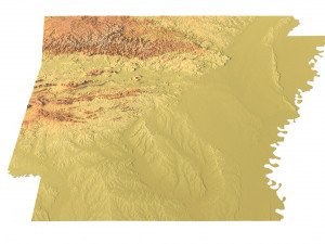
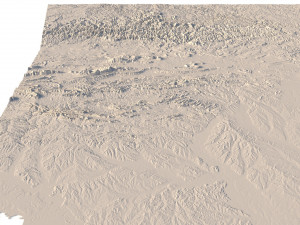
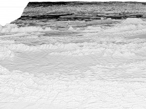
The Arkansas Topographic Map STL model provides a high-resolution representation of the state’s topography and geographic features. Perfect for creating physical relief maps from wood, metal, plastic, or concrete, this 3D model offers detailed accuracy for a variety of uses, including landform visualization, education, and professional GIS projects. Whether you’re using a 3D printer, CNC machine, or laser engraver, this model ensures precise terrain representation.
• Format: STL
• Files size: 867 MB / 450 MB
• Polygons: 18 188 670
• Vertices: 9 104 309
• Geometry: Polygonal Tris only
• Model size: 221.34 mm x 188.58 mm x 1.124 mm
• Distance between two neighboring vertices: ~ 0,06 mm
• Projection: Mercator
• Scaling factor X:Y:Z: 1:1:3
• Base: Open / Closed
Features of the Arkansas Topographic STL Model
• Detailed elevation data capturing Arkansas’ diverse landforms.
• Compatible with FDM/SLA 3D printers for creating accurate terrain models.
• Designed for CNC machining to craft wood or metal relief maps.
• Supports high-precision laser engraving for metal surface detailing.
如果你需要一个不同的格式,请打开一个新的支持票和为此请求。我们可以转换到 3D 模型: .stl, .c4d, .obj, .fbx, .ma/.mb, .3ds, .3dm, .dxf/.dwg, .max. .blend, .skp, .glb. 我们不转换 3d 场景 以及 .step、.iges、.stp、.sldprt 等格式。!