English
 Español
 Deutsch
 日本語
日本語 Polska
 Français
 中國
中國 한국의
한국의 Українська
 Italiano
 Nederlands
 Türkçe
 Português
 Bahasa Indonesia
 Русский
 हिंदी
हिंदी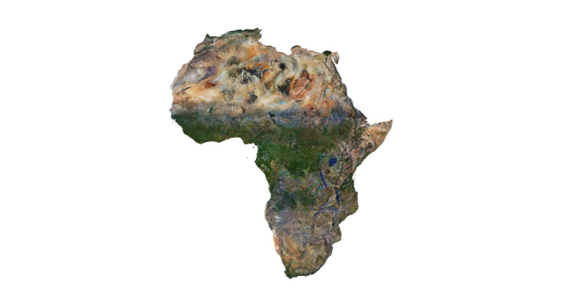


- 可用的格式: Cinema4D: c4d 933.94 MB
渲染: Standard
- 多边形:7 988 024
- 顶点:3 998 016
- 动画:No
- 纹理:
- 操纵:No
- 材料:
- 低聚:No
- 集合:No
- UVW 贴图:No
- 使用插件:No
- 打印准备:No
- 3D扫描:No
- 成人内容:No
- PBR:No
- 人工智能培训:No
- 几何:Polygonal
- 包装 UVs:Unknown
- 日期:6749
- 日期: 2024-05-24
- 项目 ID:508213
- 评分:
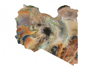
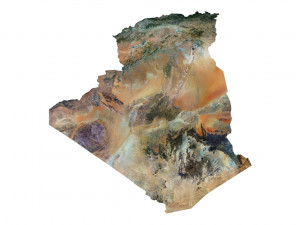
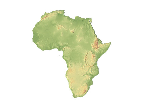
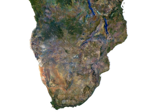
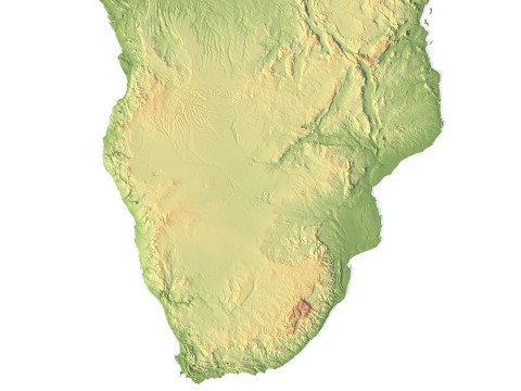
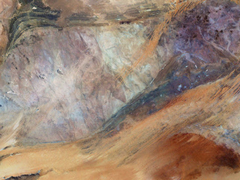
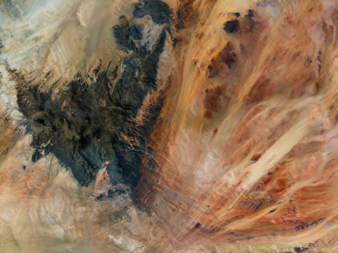
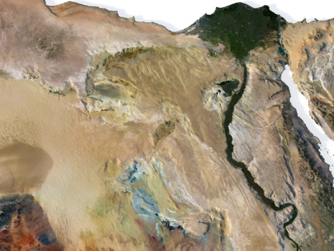
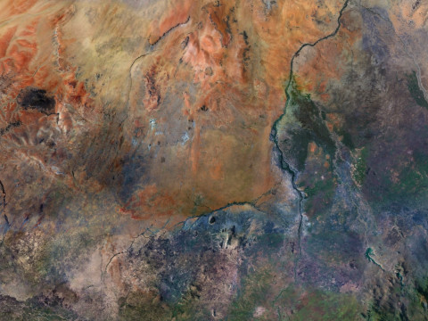
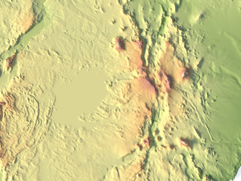
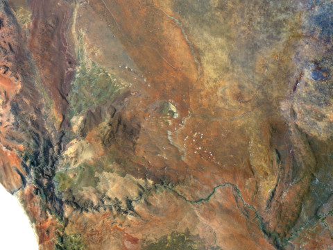
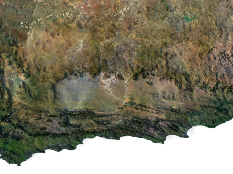
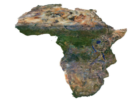
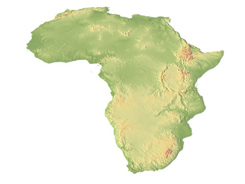
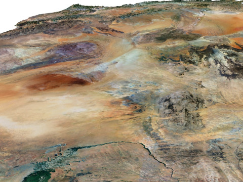
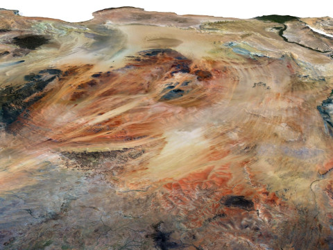
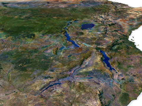
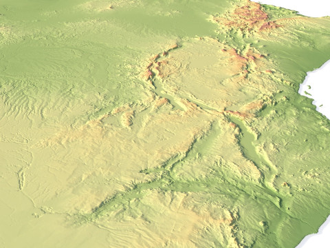
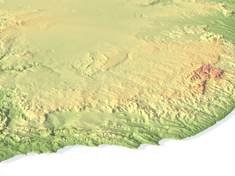
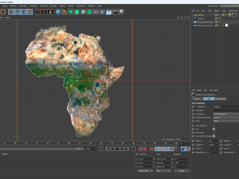
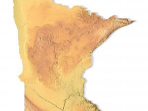
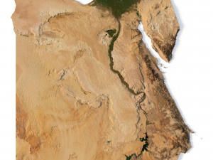
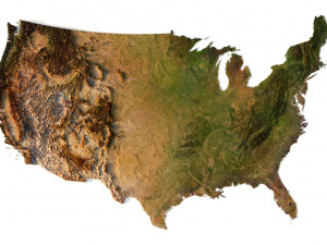
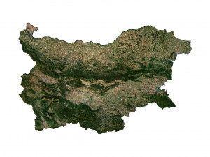
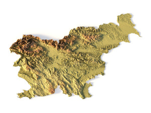
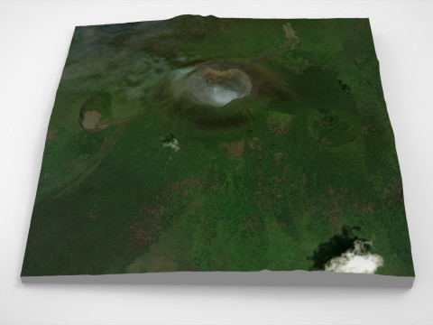
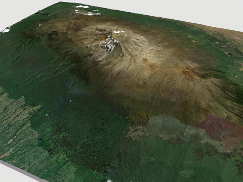
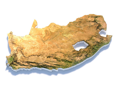
Explore the dynamic relief of the African continent with our three-dimensional model. From majestic mountains to expansive plains, open valleys, and scenic coastlines, our model provides a detailed depiction of the diversity of landscapes across this remarkable continent.
Africa Terrain 3D Map 3D Model
3D models
- Format: C4D
- File size (unzipped): 457 MB
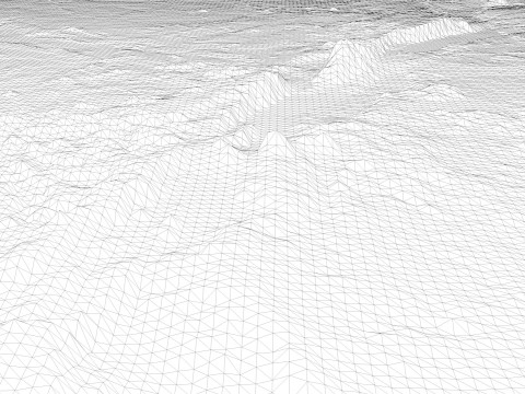
- Polygons: 7 988 024
- Vertices: 3 998 016
- Geometry: Polygonal Tris only
- Model size: 183.75 mm x 205 mm x 0.995 mm
- Projection: Mercator
- Base: Open
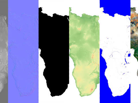
Textures
- Height Map TIF 7344*8193*16b - You can use this map in the displacement channel instead of the polygonal mesh.
- Normal Map TIF 7344*8193*48b - Use this map to reveal fine details of the relief.
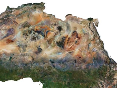
- Satellite Map TIF 14700*16400*48b
- Water Mask TIF 14700*16400*48b - Use this map for masking in the Reflection channel to get glare from the water surface.
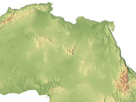
- Pseudo-color Map 14700*16400*48b - Use this map to get elevation information based on the color shade.
- Boundary Mask TIF 14700*16400*48b - Use this map as a mask for your background.
Other models can be made on request.
Modifications, conversion to OBJ, FBX, STL and other formats, more detailed models and better textures on request.
Shustrik-Maps.com – Premium 3D Models for Terrain, Maps & Beyond
High-Quality STL Files for 3D Printing & CNC
需要更多的格式吗?
如果你需要一个不同的格式,请打开一个新的支持票和为此请求。我们可以转换到 3D 模型: .stl, .c4d, .obj, .fbx, .ma/.mb, .3ds, .3dm, .dxf/.dwg, .max. .blend, .skp, .glb. 我们不转换 3d 场景 以及 .step、.iges、.stp、.sldprt 等格式。!
如果你需要一个不同的格式,请打开一个新的支持票和为此请求。我们可以转换到 3D 模型: .stl, .c4d, .obj, .fbx, .ma/.mb, .3ds, .3dm, .dxf/.dwg, .max. .blend, .skp, .glb. 我们不转换 3d 场景 以及 .step、.iges、.stp、.sldprt 等格式。!
下载 Relief of Africa Explore its Diverse Terrain 3D 模型 c4d 从 sychev23021983
africa landscape terrain map relief topography continent geographic landscapes geological cartography没有对这一项目的评论。
相关的项目 从 Relief of Africa Explore its Diverse Terrain

dae fbx mb obj stl png
deformer
Landscapes
max png obj blend
AlaaeddineZair
Landscapes